Floods · Article in Bangla, 2024

Fifty years of floods in Bangladesh

With Bibi Hafsa and Jannatun Hussna Tuya, I reviewed the major floods between 1970 and 2020, mapped the area each one covered, and combined the record into maps of flood-prone districts and flood-prone land. Published in সমাজবিজ্ঞান সমীক্ষা (Social Science Review), Jahangirnagar University, issue 7, July 2024.

Floods
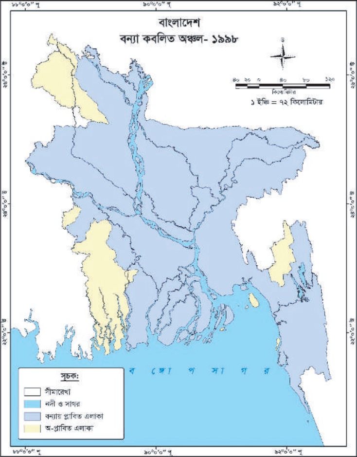
Map of areas flooded in Bangladesh in 1998
Flood-affected areas, 1998. Blue shows flooded land.
1998
the most severe flood in the record

More than two-thirds of the country went under water, and the flooding lasted over two months.
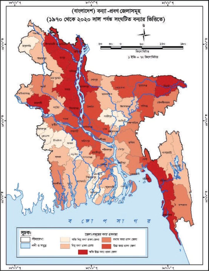
Map of flood-prone districts of Bangladesh based on floods from 1970 to 2020
Flood-prone districts, based on floods from 1970 to 2020. Darker red means more flood-prone.
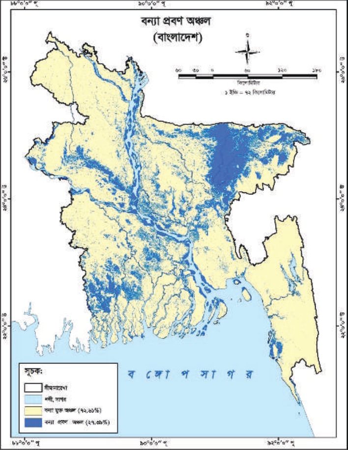
Map of flood-prone areas of Bangladesh
Flood-prone areas. Dark blue marks the land flooded most often.
27.39%
of the country flooded most often, 1970–2020

The Sylhet region in the north-east is the most flood-prone. The north-west and the Chittagong hill areas are the least. The flood-prone map was checked with an ROC curve, giving an AUC of 0.781.

Maps from Hafsa, Pobon & Tuya (2024) · Read the article

Get in touch

Open to research collaborations, graduate positions and GIS consultancy.

LinkedInResearchGateFacebook